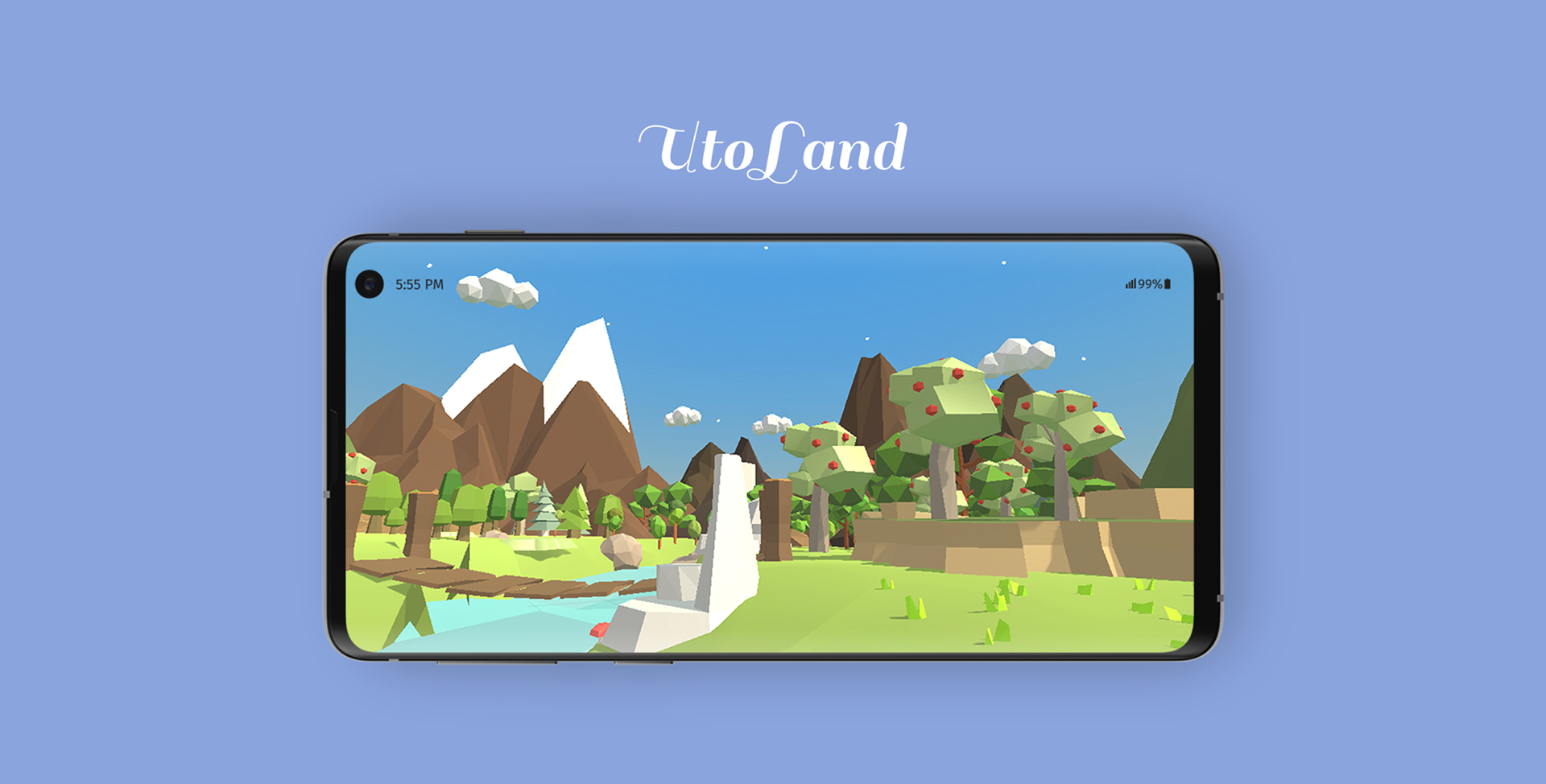
Utoland
Utoland is an interesting, engaging exploration of natural landforms. The app combines course-inspired, interactive 3D nature simulations and educational content, which enable an immersive and game-like experience for curious minds.
Group Project | August 2018
Education, Interaction, Prototyping, Modeling, Geography
Inspiration
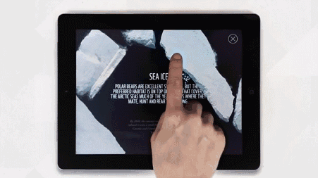
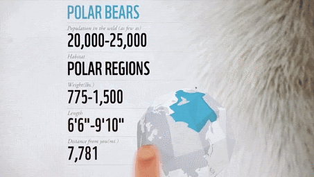
In 2016, I and my partner Corrie downloaded the "WWF Together" app by chance and we were deeply attracted by it. It uses concise design, photographs, videos, and rich and interesting interactions to show the knowledge of different wild animals, and it also evokes people's awareness of protecting animals.
Corrie and I were both liberal arts students in high school. Geography was one of the subjects for the college entrance examination and it was also a quite difficult one for us, because by only looking at the schematic diagrams of the textbook, sometimes it is difficult to imagine the geographic structures.
Then we thought, why not use such interesting interactions to show natural terrain and landforms, and help middle school students better understand geography? Our goal was to go beyond the textbook and turn puzzling subjects into smart toys, a multi-layer journey where curious minds can play, experiment, and learn with ease.
Concept
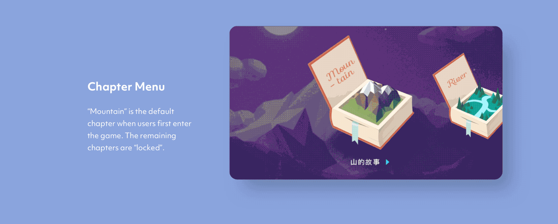
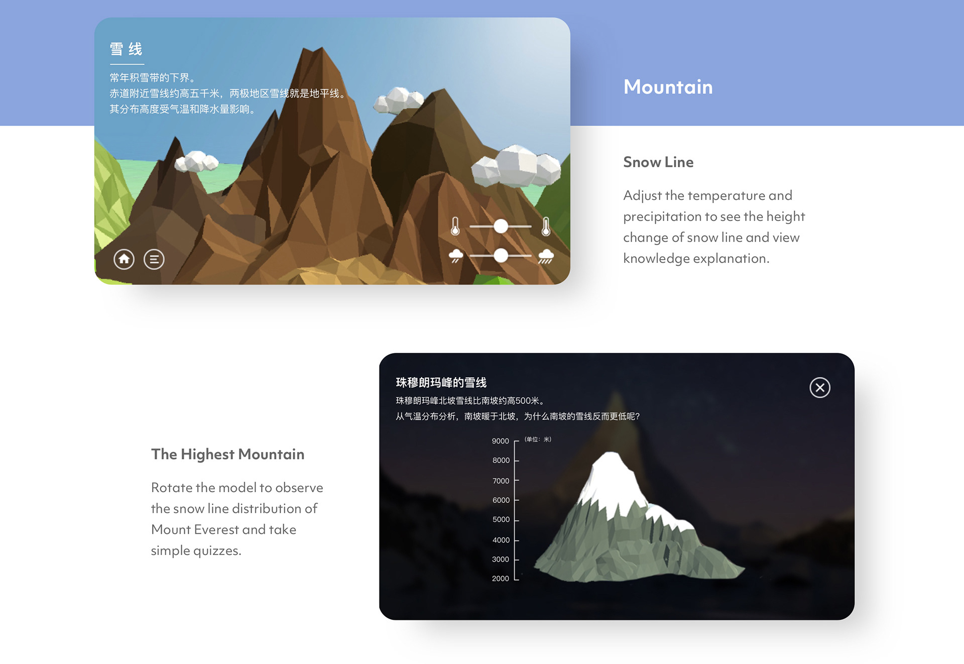
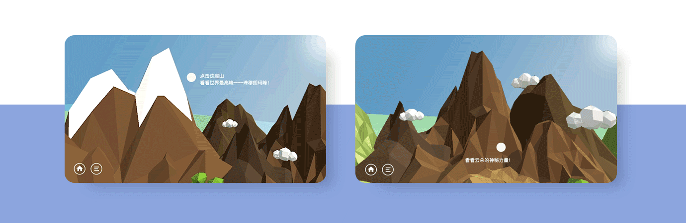
First, the mountain was chosen as the main scene for it is one of the most basic landforms in nature and it is the focus of geography courses in high school. Then the lo-fi prototype and usability test were conducted to verify the feasibility of the concept and optimize it. The following two feedback were summarized after the test:
1) The sense of exploration is weak
There are only mountain models at the moment, and it feels like looking at slides rather than exploring.
2) What will happen next?
So far a few knowledge points about mountains have been said, but users wonder what would happen after it rains?
Concept Expansion
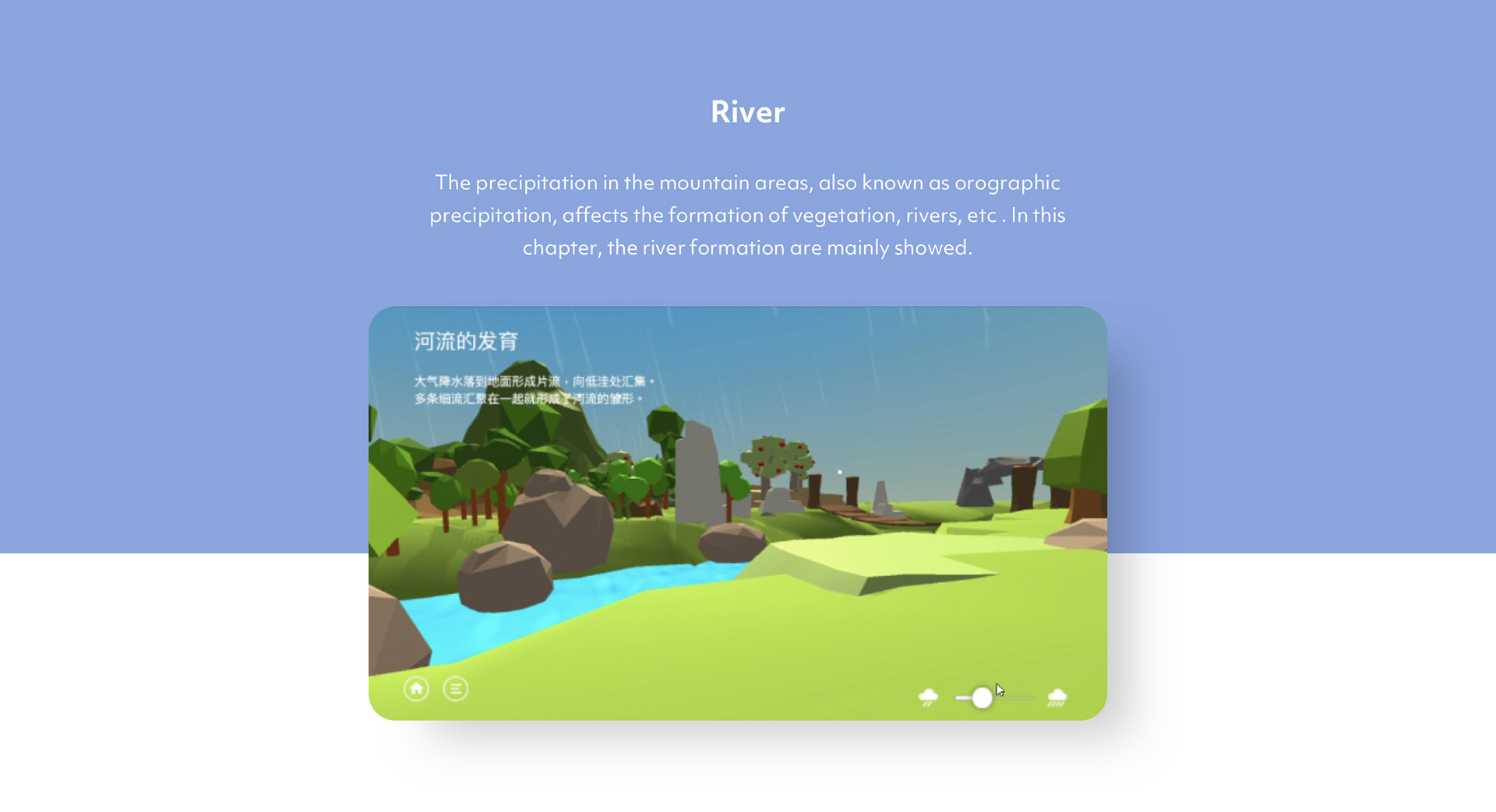
Based on the two main problems from the user test, the following two adjustment directions were summarized:1) Create a richer and more complete landscape with the first-person perspective to enhance the sense of exploration; 2) Extend more subsequence geographic phenomenon and related knowledge to help shape a more complete geographical exploration experience.
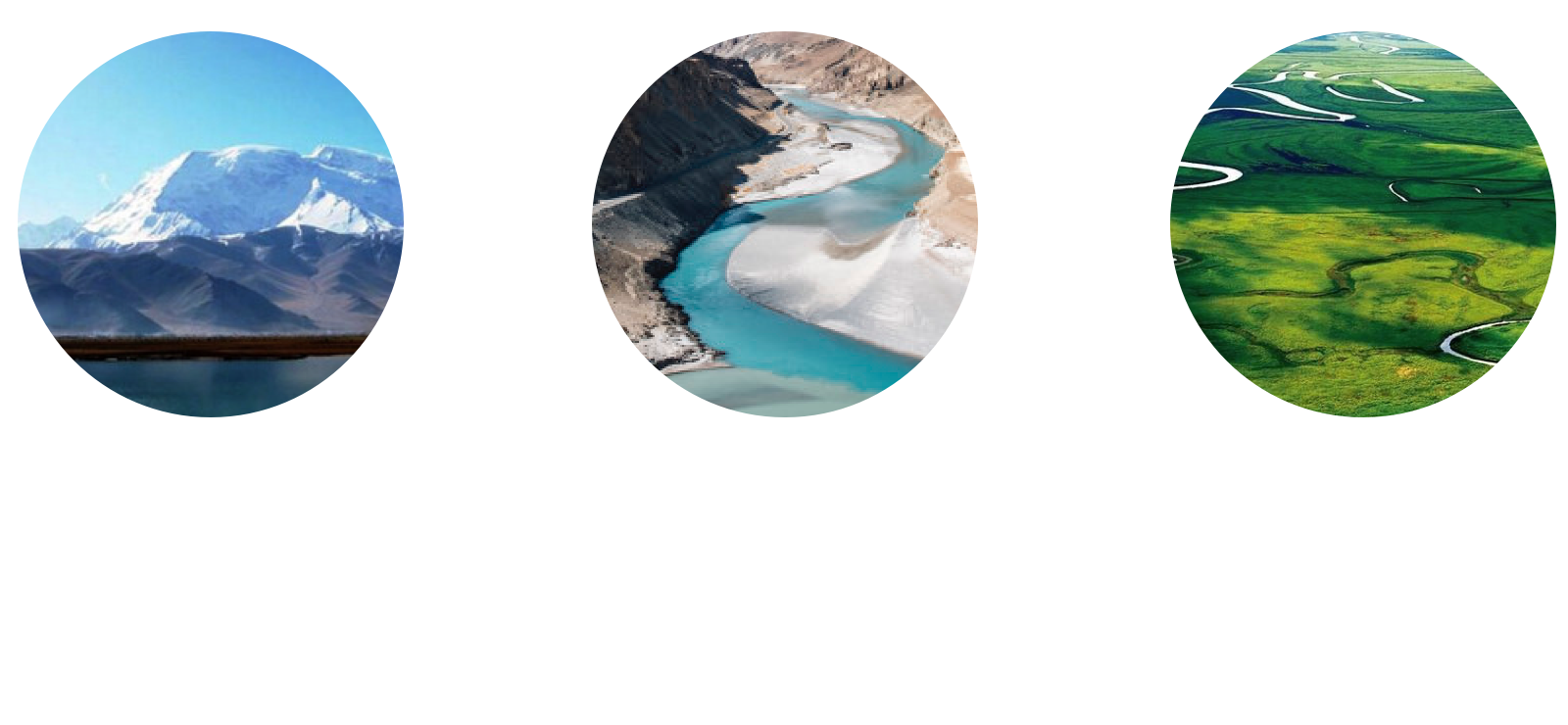
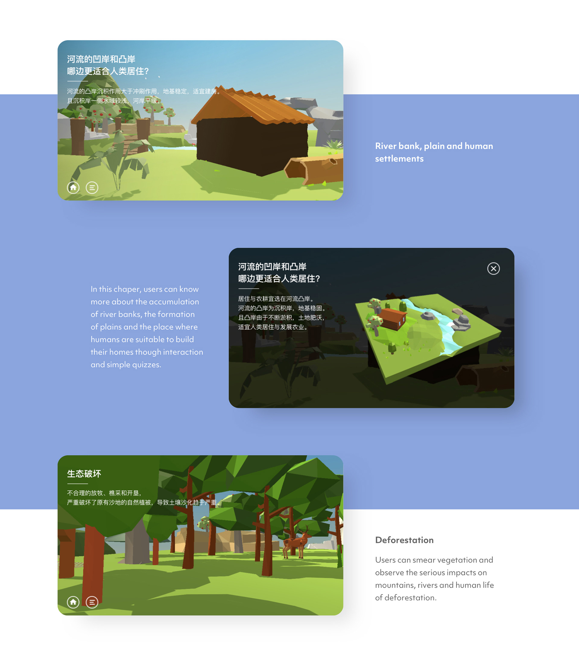
Then the contents in the geography textbooks around the two themes: river and plain were selected to extend the knowledge points.
Design and Refine
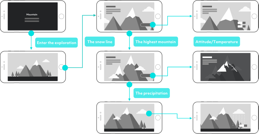
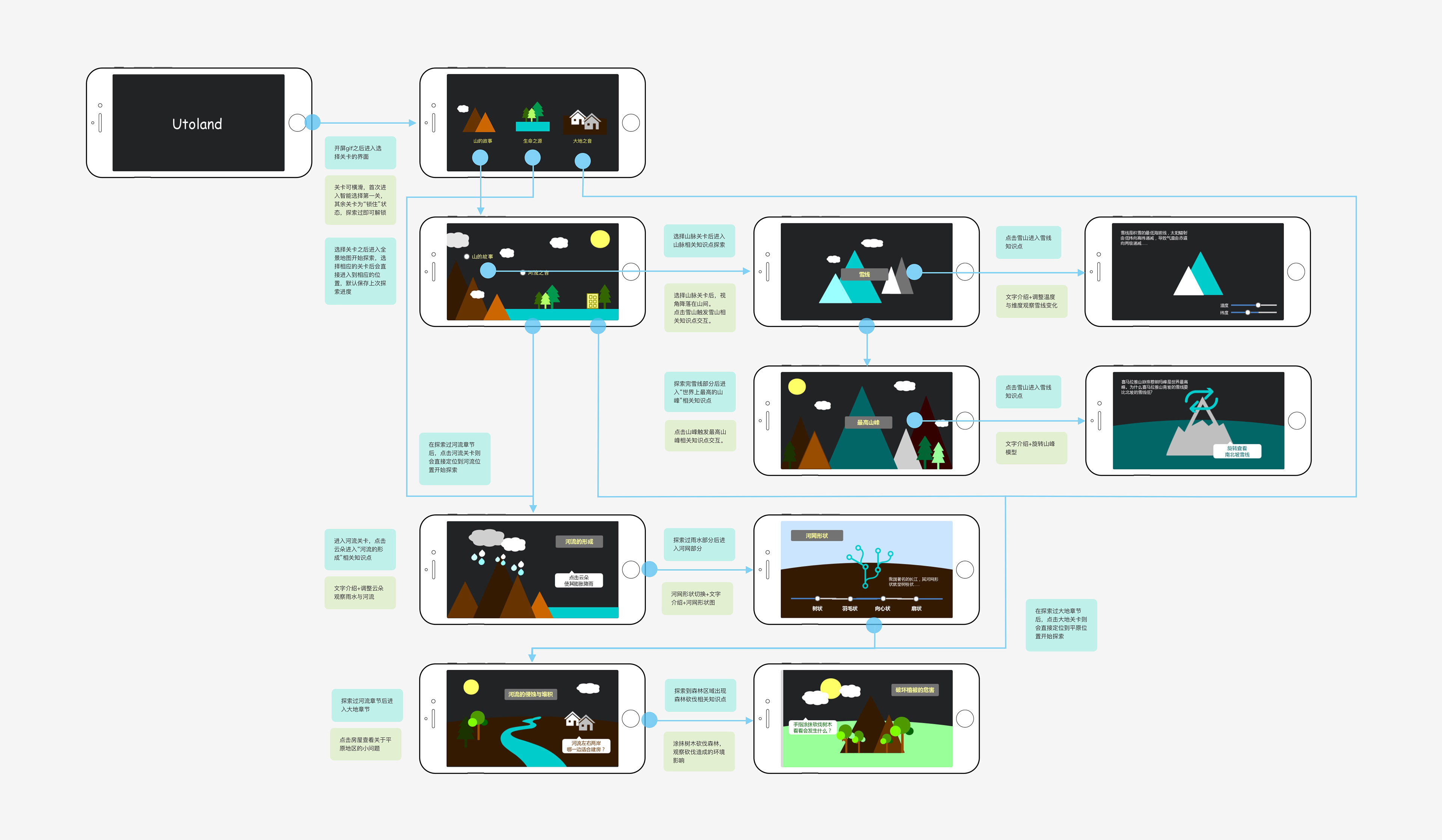
Flow Chart & Wireframes
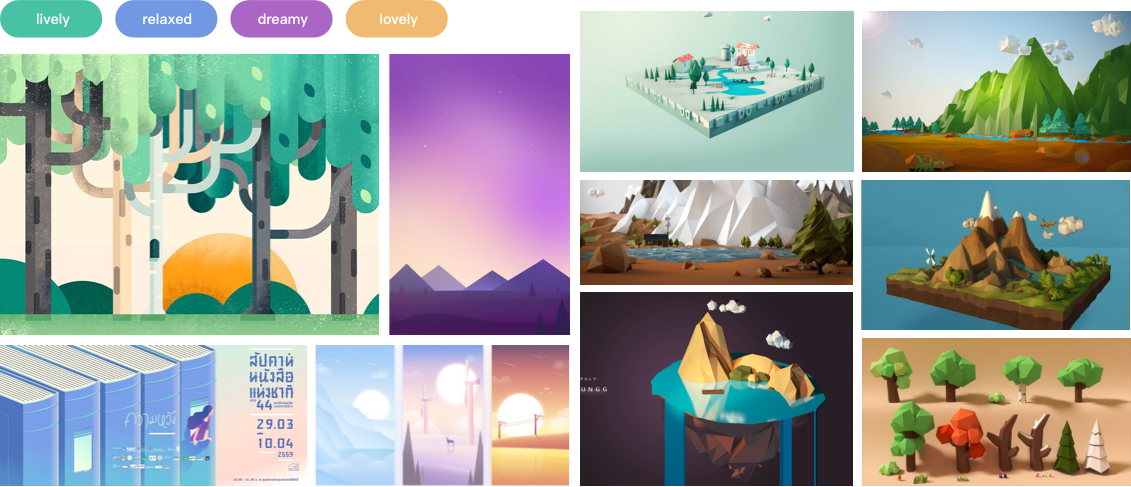
Visual Settings
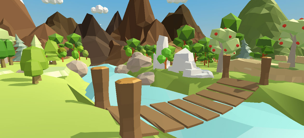
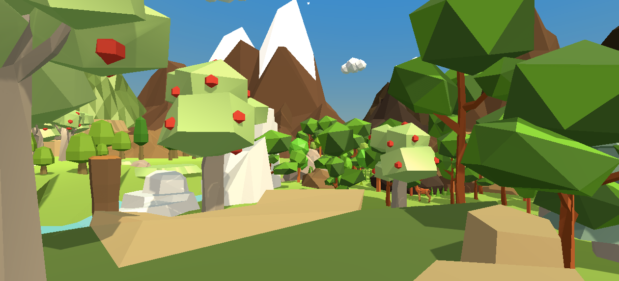
In terms of visual style, we use the popular low poly style, which is very compatible with 3D simulations and less time-consuming in the modeling phase. Because the 3D landscape is the main scene of the product, we defined the overall visual style by conducting mood boards and visual and modeling references at the concept phase.
Modeling
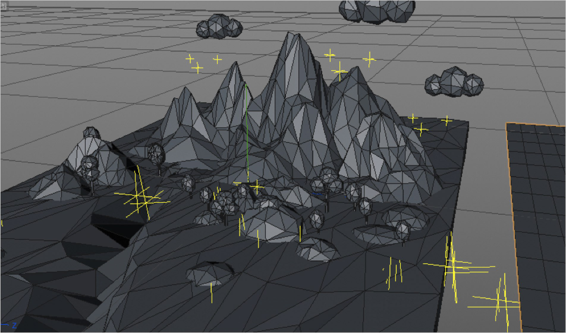
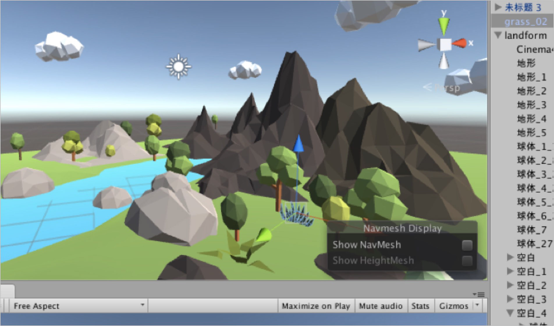
I mainly used Cinema4D and Unity to model the landscape map. It was very challenging for me to use completely unfamiliar software, but I learned them by watching the instructional videos online and following the teaching exercises, which was a somewhat difficult but interesting process. Here are some images of the map from different perspectives.
Interaction & Interface Outcome
Utoland Demo Video